November 2, 2009
Working the Line
Mike Dryland
Report by: Mike Dryland
A complicated set of circumstances …
prevented our scheduled speaker from coming to Greenwich and so Mike stepped into the breach (ta-ra!).
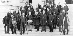
October 2009 was the 125th anniversary of the recognition of Greenwich as prime meridian of the world, zero degrees longitude, by an international conference held in Washington DC. Mike’s talk explained how this came about starting with founding of the Greenwich Observatory by King Charles II in 1675, and coming up to date with the appearance of the GPS satellite navigation system and the 5th (yes, 5th) Greenwich meridian.
In the late 17th century, navigators on ships in the ocean, out of sight of land, were lost. They had no accurate or scientific way of finding their longitude (distance east-west of their home port or destination). Many voyages were ending in shipwreck and this led to huge loss… of wealth! To find longitude east or west of Greenwich (say) it’s necessary to know the time difference between local time at your present location, and Greenwich time at the same moment. Lacking an accurate clock that would work on a ship, the best chance to find Greenwich time anywhere in the world was to use astronomy. The ’lunar distance’ method used the Moon like the hand of a clock where the stars were the ’numbers’ on the clock face. In 1675 astronomy measurements were not sufficiently accurate to use this approach for navigation. That is why the Observatory was founded to enable the first Astronomer Royal, John Flamsteed, to map the stars accurately and plot the course of the Moon so that the necessary tables, or almanac, could be printed.
Mike’s talk described how John Flamsteed worked over 43 years at the problem but ran out of time before he was finished! Mike gave special emphasis to the career of the second AR, the great Edmund Halley who picked up the work for another 20 years. Eventually it all came to fruition in the time of the 5th AR, Nevil Maskelyne, who was able to publish the tables as the Nautical Almanac — an annual publication which developed a world-class reputation for accuracy. By 1883 navigation based on Greenwich tables and charts was so well established that the US railroads adopted a time-zone system based on the Greenwich meridian to rationalise their timetables and time keeping — a short step to the recommendation by the conference in 1884.
Adoption of the Greenwich meridian was not instant. The meridian was not officially recognised by France until 1913. Even then, the legislators in France could not bring themselves to mention Greenwich — the regulations referred to ‘Paris time diminished by 9 mins and 21 seconds’.
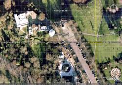
Mike ended with a short survey of the 5 meridian lines used at Greenwich — the first 3 by the early Astronomers Royal, Flamsteed, Halley, and Bradley who moved eastward as they updated their equipment. Then came the formidable George Airy who established a new meridian position in 1851, the same place as adopted by the conference in 1884. Now day-to-day accurate navigation and timekeeping is thanks to the GPS ‘Global Positioning System’ which uses a system of Earth orbiting satellites controlled by the US Naval Observatory, Washington. For reasons too long to repeat here, the GPS prime meridian is 102.5 metres east of the 1884 meridian — no, not wrong, just different!
Posted under: Flamsteed, Flamsteed Lecture, Meeting Report

You must be logged in to post a comment.